YOUR NEXT DISCOVERY/SpaceFollow your curiosity
Callisto False Color
NASA / JPL · Reuse terms

Space / 1996-09-26

Callisto False Color

Callisto False Color

NASA's image library records Callisto False Color.

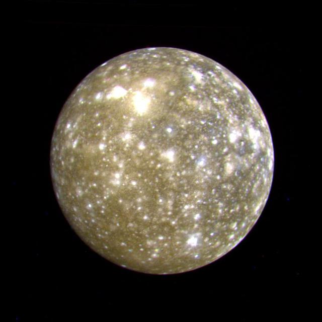
This false color picture of Callisto was taken by NASA's Voyager 2 on July 7, 1979 at a range of 1,094,666 kilometers (677,000 miles) and is centered on 11 degrees N and 171 degrees W. This rendition uses an ultraviolet image for the blue component. Because the surface displays regional contrast in UV, variations in surface materials are apparent.

SERENDIPITYA little unexpected
FamiliarWeird

This false color picture of Callisto was taken by NASA's Voyager 2 on July 7, 1979 at a range of 1,094,666 kilometers (677,000 miles) and is centered on 11 degrees N and 171 degrees W. This rendition uses an ultraviolet image for the blue component. Because the surface displays regional contrast in UV, variations in surface materials are apparent. Notice in particular the dark blue haloes which surround bright craters in the eastern hemisphere. The surface of Callisto is the most heavily cratered of the Galilean satellites and resembles ancient heavily cratered terrains on the moon, Mercury and Mars. The bright areas are ejecta thrown out by relatively young impact craters. A large ringed structure, probably an impact basin, is shown in the upper left part of the picture. The color version

Explore NASA's original image record for credits and available downloads.

NASA Image and Video LibraryCallisto False Color

Original explanation based on the sources above. Images carry their own reuse terms.